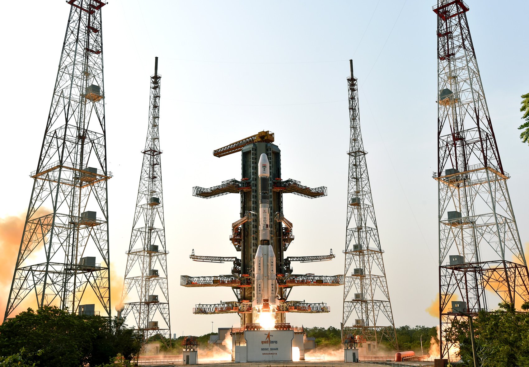
GSLV Mk II | NISAR (NASA-ISRO Synthetic Aperture Radar)
Launch information
Favourite EmbedMission description
The NASA-ISRO Synthetic Aperture Radar, or NISAR satellite, will use advanced radar imaging to map the elevation of Earth's land and ice masses 4 to 6 times a month at resolutions of 5 to 10 meters. It is designed to observe and measure some of the planet's most complex natural processes, including ecosystem disturbances, ice-sheet collapse, and natural hazards such as earthquakes, tsunamis, volcanoes and landslides. Under the terms of the agreement, NASA will provide the mission's L band synthetic aperture radar (SAR), a high-rate telecommunication subsystem for scientific data, GPS receivers, a solid-state recorder, and a payload data subsystem. ISRO will provide the satellite bus, an S band synthetic aperture radar, the launch vehicle, and associated launch services.
Launch status
Launch status information for space mission ‘GSLV Mk II | NISAR (NASA-ISRO Synthetic Aperture Radar)’.
TBC
Status: To Be Confirmed
Class: normal
Launch T0: July 30, 2025, 11:30 a.m.
Timezone: Asia/Kolkata
Launch authority
Details about the the rocket, its target orbit and the launch pad location.
Mission |
NISAR (NASA-ISRO Synthetic Aperture Radar) (SSO) |
|---|---|
Launcher |
Indian Space Research Organization |
Rocket |
GSLV Mk II |
Location |
Satish Dhawan Space Centre, India |
Pad |
Satish Dhawan Space Centre Second Launch Pad |
Type |
Earth Science |
Orbit |
Sun-Synchronous Orbit (SSO) |
Satellites on-board
Tracking of on-board satellites will be available after the rocket launch date (July 30, 2025).
Launch statistics
Launch statistics will be available after the rocket launch date (July 30, 2025).
Latest news about the launch
News about the space mission ‘GSLV Mk II | NISAR (NASA-ISRO Synthetic Aperture Radar)’ are fetched daily from the best sources online.

NASA-ISRO Mission Will Map Farmland From Planting to Harvest
Data from the NISAR satellite will be used to map crop growth, track plant health, and monitor soil moisture — offering detailed, timely information for decision making. When it launches this year, the NISAR (NASA-ISRO Synthetic Aperture Radar) satellite ...

NASA JPL Prepping for Full Year of Launches, Mission Milestones
Missions will study everything from water on the Moon to the transformation of our universe after the big bang and ongoing changes to Earth’s surface. With 2024 receding into the distance, NASA’s Jet Propulsion Laboratory is already deep into a busy 2025....

How New NASA, India Earth Satellite NISAR Will See Earth
Set to launch within a few months, NISAR will use a technique called synthetic aperture radar to produce incredibly detailed maps of surface change on our planet. When NASA and the Indian Space Research Organization’s (ISRO) new Earth satellite NISAR (NAS...

Newsletter sign-up
Weekly statistics, charts and insights to help you stay on top of the space industry.
