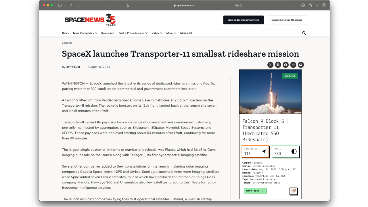
Key statistics
Satellite ALOS DEB at a glance.
Uptime
7266
Days in orbit
Revolutions
≈ 14.8
Per day
Orbit
SSO
Sun Synchronous Orbit
Inclination
98.0
Latest
Satellite identification and parameters
Extended collection of information and parameters for ALOS DEB.
Object identification
Identified? True
Debris? True
Object name: ALOS DEB
International designator: 2006-002AA
Object number (NORAD): 36571
Object ID (CCSDS): 36571
Country: JAPAN (JPN)
Current information (Y/N): Y
RCS size: SMALL
Orbital parameters
Period: 97.072 minutes
Inclination: 98.0228 deg
SMA: 6996.661 km
Apoapsis: 620.305 km
Periapsis: 616.747 km
RAAN: 316.0064 deg
Eccentricy: 0.00025429
Argument of periapsis: 78.0453 deg
Mean anomaly: 282.1046 deg
Mean motion: 14.83428047 rev/day
Mean motion (dot): 0.00003736 rev/day2
B* drag term: 0.0004615427 1/REarth
Two-line elements (TLE)
Creation date: Dec. 16, 2025, 2:19 a.m.
Reference frame: TEME
Reference center: EARTH
Epoch: Dec. 15, 2025, 8:19 p.m. UTC
TLE line 0: 0 ALOS DEB
TLE line 1: 1 36571U 06002AA 25349.84667582 .00003736 00000-0 46154-3 0 9991
TLE line 2: 2 36571 98.0228 316.0064 0002543 78.0453 282.1046 14.83428047836500
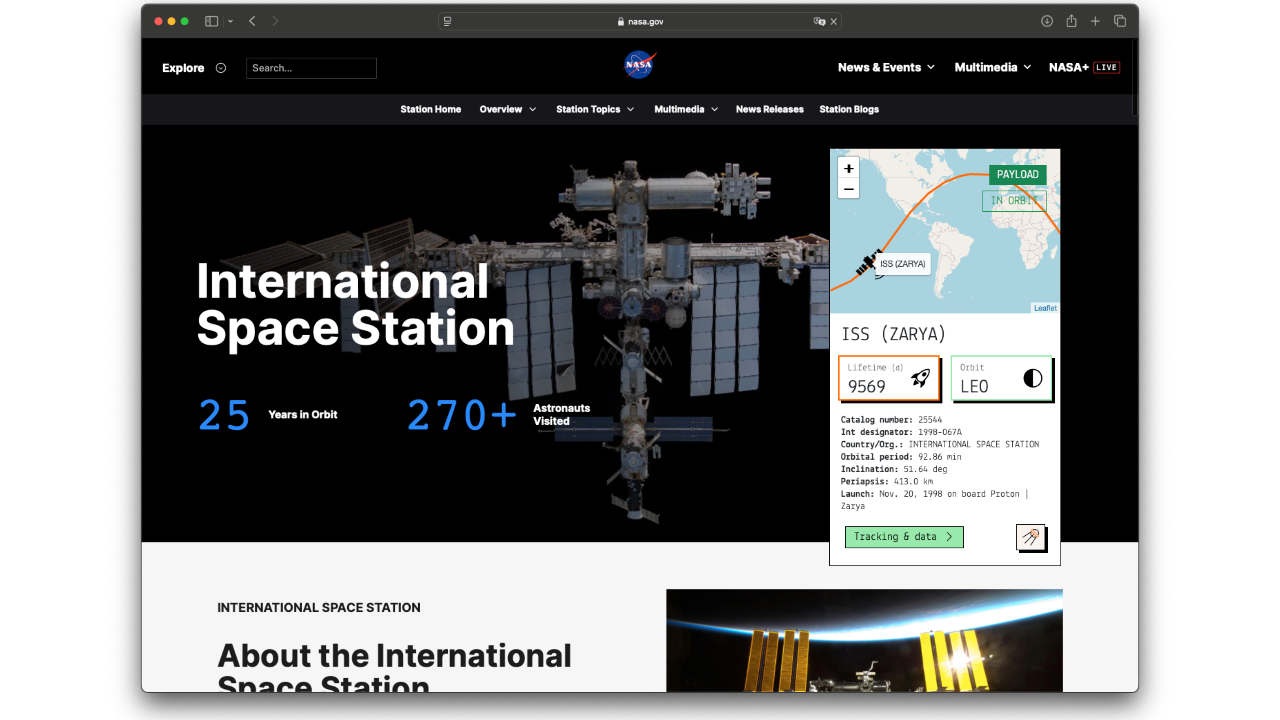
Live tracking on map
Real-time ground track for satellite ALOS DEB.
Associated space launch
ALOS (Advanced Land Observation Satellite) is used for cartography, regional observation, disaster monitoring, and resource surveying. ALOS has three remote-sensing instruments: - the Panchromatic Remote-sensing Instrument for Stereo Mapping (PRISM) for digital elevation mapping with 2.5 meter resolution, - the Advanced Visible and Near Infrared Radiometer type 2 (AVNIR-2) for precise land coverage observation with 10 meter resolution, and - the Phased Array type L-band Synthetic Aperture Radar (PALSAR) for day-and-night and all-weather land observation. ALOS transmitts its data via the DRTS (Kodama) satellite. The ALOS was launched by an H-2A-2022 launch vehicle from the Tanegashima Space Center. ALOS as been given the nickname Daichi. Five minutes after spacecraft separation, ALOS began to unfurl its 72-foot solar array that will provide electrical power to the craft throughout its mission. Six cameras are on-board to visually verify the correct deployment of the solar panel and various instrument antennas. ALOS lost all power on 22. April 2011, thus ending the mission.
ALOS DEB was lifted into orbit during the mission ‘H-IIA 2022 | Daichi’, on board a H-IIA 2022 space rocket.
The launch took place on Jan. 24, 2006, 1:33 a.m. from Yoshinobu Launch Complex LP-1.
For more information about the launch, click the button.
H-IIA 2022 | Daichi
Agency: N/A
Status: Launch Successful
Launch date: Jan. 24, 2006, 1:33 a.m. UTC
Rocket: H-IIA 2022
Launch pad: Yoshinobu Launch Complex LP-1
Location: Tanegashima Space Center, Japan
...
Latest news about this satellite
There are no fresh news available about this satellite. Check back as we update our databases every day.

Newsletter sign-up
Weekly statistics, charts and insights to help you stay on top of the space industry.
