Key statistics
Satellite GCOM W1 at a glance.
Uptime
4958
Days in orbit
Revolutions
≈ 14.6
Per day
Orbit
SSO
Sun Synchronous Orbit
Inclination
98.2
Latest
Satellite identification and parameters
Extended collection of information and parameters for GCOM W1.
Object identification
Identified? True
Debris? False
Object name: GCOM W1
International designator: 2012-025A
Object number (NORAD): 38337
Object ID (CCSDS): 38337
Country: JAPAN (JPN)
Current information (Y/N): Y
RCS size: LARGE
Orbital parameters
Period: 98.825 minutes
Inclination: 98.2214 deg
SMA: 7080.611 km
Apoapsis: 703.503 km
Periapsis: 701.449 km
RAAN: 284.4859 deg
Eccentricy: 0.00014505
Argument of periapsis: 69.1841 deg
Mean anomaly: 101.1386 deg
Mean motion: 14.5712449 rev/day
Mean motion (dot): 0.00001125 rev/day2
B* drag term: 0.00025968319 1/REarth
Two-line elements (TLE)
Creation date: Dec. 12, 2025, 10:14 a.m.
Reference frame: TEME
Reference center: EARTH
Epoch: Dec. 12, 2025, 6:32 a.m. UTC
TLE line 0: 0 GCOM W1
TLE line 1: 1 38337U 12025A 25346.27235742 .00001125 00000-0 25968-3 0 9998
TLE line 2: 2 38337 98.2214 284.4859 0001450 69.1841 101.1386 14.57124490721817
Live tracking on map
Real-time ground track for satellite GCOM W1.
In-orbit conjunctions
There are no conjunctions computed for GCOM W1, at the moment. Check back to stay up to date, as we update our databases every day.
Go to all conjunctionsAssociated space launch
The GCOM-W (Global Change Observation Mission - Water) or Shizuku satellite aims to construct, use, and verify systems that enable continuous global-scale observations (for 10 to 15 years) of effective geophysical parameters for elucidating global climate change and water circulation mechanisms. Water circulation changes will be observed by a microwave radiometer onboard the GCOM-W (Water) satellite (scheduled to be launched in Japan Fiscal Year 2011). The GCOM-W will observe precipitation, vapor amounts, wind velocity above the ocean, sea water temperatures, water levels on land areas and snow depths. Climate change observation will be performed by a multi-wavelength optical radiometer onboard the GCOM-C (Climate) satellite (under consideration) on clouds, aerosol, seawater color (marine organisms), vegetation, snow and ice. These satellites will enable us to perform comprehensive observations of the surface layer of the Earth such as the atmosphere, including clouds, land, oceans and the cryosphere. The Advanced Microwave Scanning Radiometer 2 (AMSR2) is a sensor to observe radiometers, or microwaves emitted naturally from the ground, sea surface and atmosphere, using 6 different frequency bands ranging from 7 GHz to 89 GHz. The strength of a natural microwave is determined by its characteristics and moisture, including the surface condition and temperature of the material. Although it depends on the frequency, the microwave is very weak. AMSR2 will detect such weak microwaves at an altitude of 700 kilometers and measure the strength of them with a very high accuracy. For example, by measuring the strength of a microwave emitted from the sea surface with the AMSR2, one can understand the water temperature of the sea surface to an accuracy of 0.5 degrees Celsius.
GCOM W1 was lifted into orbit during the mission ‘H-IIA 202 | GCOM-W1’, on board a H-IIA space rocket.
The launch took place on May 17, 2012, 4:39 p.m. from Yoshinobu Launch Complex LP-1.
For more information about the launch, click the button.
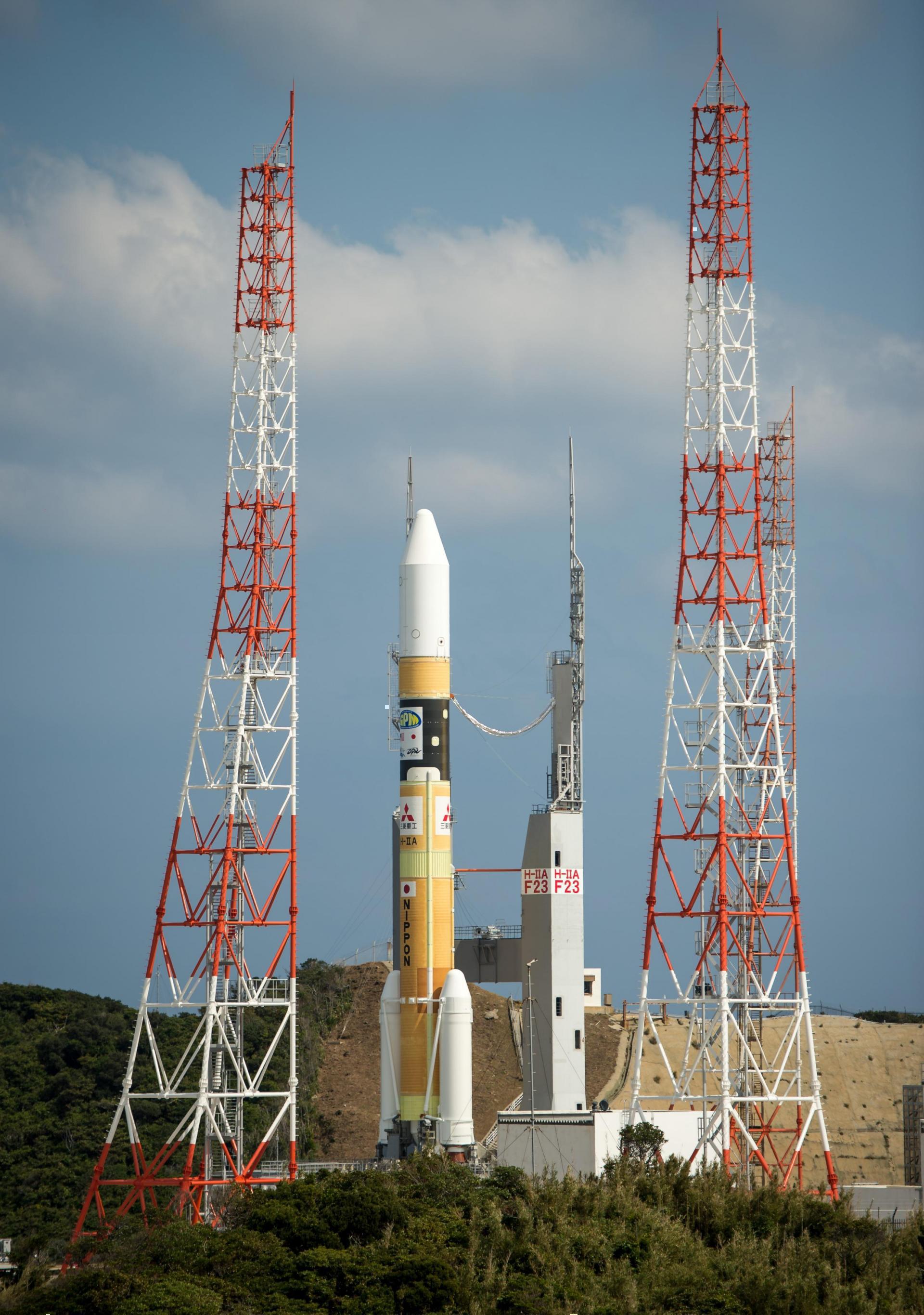
H-IIA 202 | GCOM-W1
Agency: N/A
Status: Launch Successful
Launch date: May 17, 2012, 4:39 p.m. UTC
Rocket: H-IIA
Launch pad: Yoshinobu Launch Complex LP-1
Location: Tanegashima Space Center, Japan
...
Latest news about this satellite
There are no fresh news available about this satellite. Check back as we update our databases every day.

Newsletter sign-up
Weekly statistics, charts and insights to help you stay on top of the space industry.
